Vector data
Many river ranking tools require the use of rasters (namely a digital elevation model). This plugin does not require this, it uses vector spatial data only.
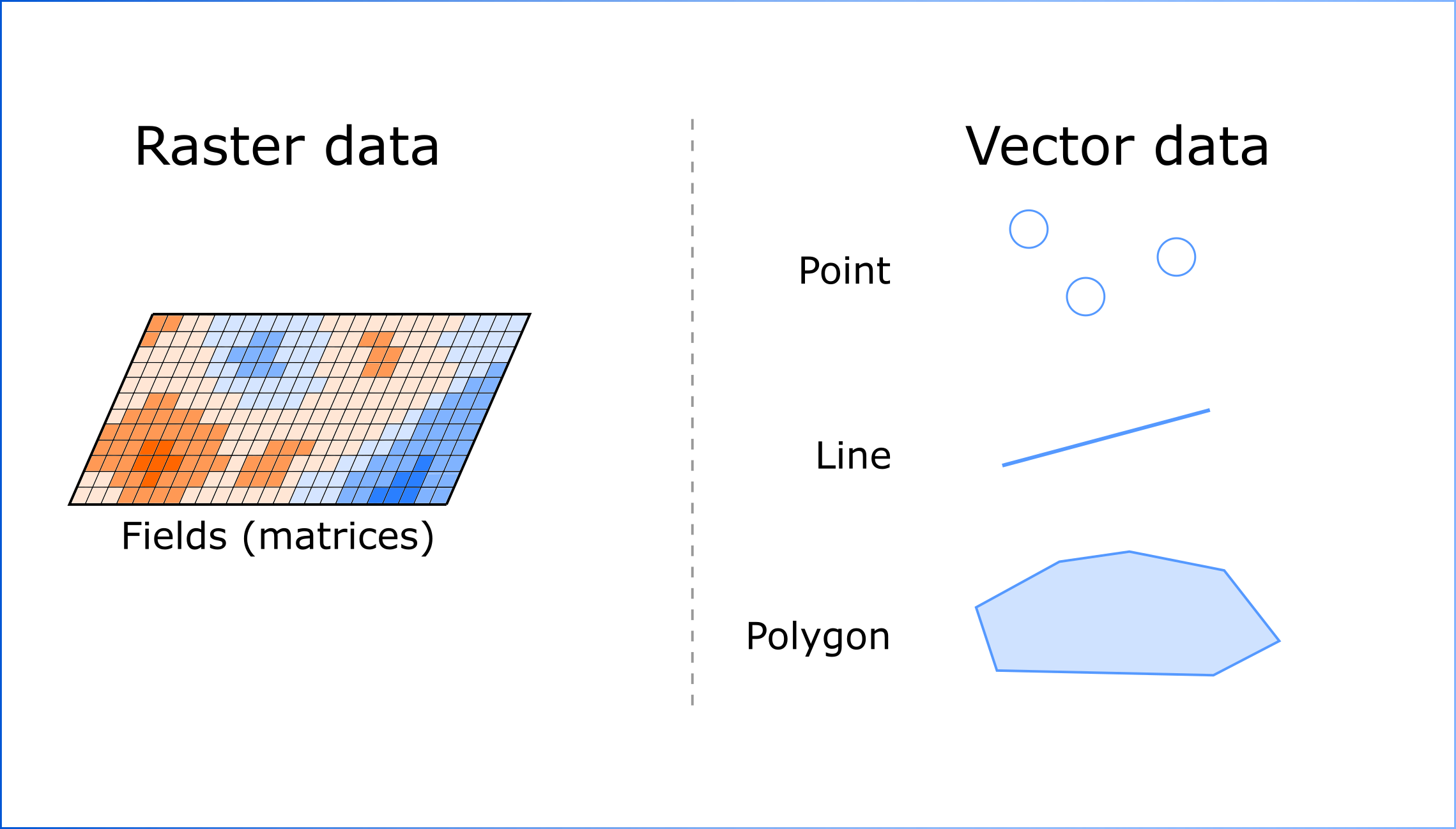
If you are new to spatial data, please take a look at the picture below - it will help you understand better how this type of data is organized:

That is, each spatial object is assigned a set of characteristics in the form of a table - attribute table. Lines Ranking plugin allows to enrich this attribute table with new values